
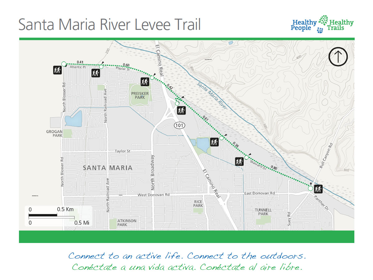
 What to expect: The Santa Maria River Levee Trail parallels the northeast edge of Santa Maria with easy access at multiple locations along the 6.7-mile route. The trail offers expansive views of the nearby mountains and Santa Maria Valley’s landscape. The generally flat course is popular with walkers, runners, and cyclists. In addition, four interpretive panels along the trail provide information about the area’s plants and wildlife.
Description: The wide trail has seven gateway locations ranging from Bull Canyon Road on the southeast end and North Blosser Road on the northwest end. A short side trip will connect trail-goers with Preisker Park. Head south from the trail along Preisker Lane to reach Santa Maria’s largest park. It offers a large grassy area for sports, a pond and creek, playgrounds, picnic areas with barbecue pits, and restrooms.
Northwest Trailhead: N. Blosser Road 34.989361, -120.452336
Southeast Trailhead: Bull Canyon Road 34.968298, -120.404399
Directions: To get to the trailhead at Seaward Drive and Carlotti Drive from Hwy 101, exit 172 to Donovan Road, and turn east towards the river. Turn north (left) onto Carlotti Drive and park on a side street near Seaward Drive.
- Difficulty Rating: Easy
- Distance: 6.7 Miles out and back
- Grade Change: Less than 5%
- Trail Layout: Linear
- Surface: Gravel and asphalt
- Average Width: 18-feet
- Shade: Limited
- Obstacles: None identified
- Accessibility: Not rated
- Restrictions: No motorized vehicles
- Emergency: Call 911
Special thanks to Wildling Museum of Art and Nature for creating Art from the Trails, a juried invitational exhibition, showcasing trail systems in Santa Barbara County. The exhibit is ongoing through October 3, 2021.